AI / Machine Learning / cv-10
Drone Site Progress Mapper
Turns image and video streams into automated inspection, safety, and operational intelligence.
Commercial Scale
$30,600 USD
Risk Reduced
Operational Continuity
Executive Situation
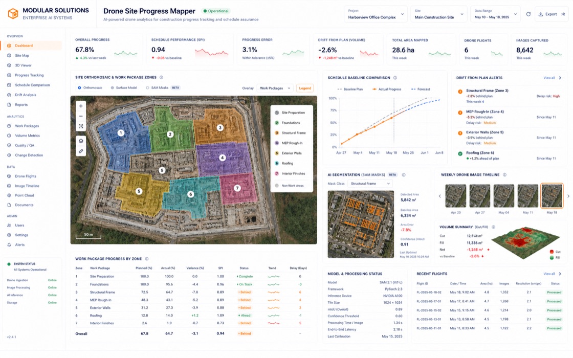
Construction teams needed objective progress tracking from drone imagery instead of manually comparing weekly photos and contractor reports.
Modular Solutions Response
We combined orthomosaic alignment, segment-anything masks, and work-package classifiers to measure visible progress by zone. The system compares current imagery to schedule baselines and highlights areas drifting from plan.
Industry
Manufacturing
Category
Computer Vision & Spatial Intelligence
Specialty
Production
Evidence Basis
Model + MLOps
parameters
632M segmentation + classifier stack
latency
14min site batch
training
97 GPU hours
loss
L = Dice(mask) + MAE(progress)
Enterprise Security Gate
Network Access Restricted.
Detailed files, client-specific assumptions, and delivery channels remain controlled.